by Brian Thomas
The Backstory
I hadn’t thought much lately about Mt. LeConte until last April (2015) when two high school seniors, Kyle McMullen and Chad Gibson, contacted me about how to hike all of the LeConte trails in one whack. I have known these young men for years, including having them in my Sunday School class when they were 10th graders.
As a result, I spent a considerable amount of time revisiting the hike that I’d taken with my buddy Shawn Carson, his son Tyler, and Davis Soehn in 2011. Here are a few of the lessons learned from that hike that I sent Kyle and Chad:
- I came up with a different route that minimized transit time between trailheads.
- I would start in the morning instead of late at night (we started at midnight). We were already pretty tired from being up all day. We ended up going over 40 hours without sleep. If you start soon after waking up and are able to get some sleep the next day after finishing, you could gain 12-14 hours of sleep.
- With this route, you would leave a car at the finish (Greenbriar) and drive to the start (Rainbow). You would need someone to meet you at Alum Cave to drive you to Newfound Gap to start the Boulevard.
Once the juices started flowing, I had no other option than to call Shawn and ask if he was ready to try it again. He was very excited about the idea, but was in the midst of finishing up his 900 miler – hiking all trails in the Great Smoky Mountain National Park. He said he would be done over the summer and perhaps we could revisit the idea at that point.
On August 9, 2015, the following text showed up on my phone from Shawn: “LeConte 24?” He had finished his 900 miler a few days before and was ready for another challenge. In fact, he decided that hiking all LeConte trails would be a great way to officially kick off his second 900 miler. Follow along with his 900 mile journey here: www.900milerblog.com.
We set a date (September 19, 2015) and had 3.5 weeks to plan. It turns out that the date we selected was the exact weekend that we did it 4 years ago. We met over lunch a couple of times and shared texts to discuss what we would do differently this time. Our main question was “Are we as fit as we were 4 years ago?”
The Route
The first thing we did was take a look at the route we chose in 2011 to see if we would do anything differently. As a refresher, here is what we did then, with actual times for each segment.

After thoroughly analyzing the route, we decided that the shuttle to Greenbriar took too long. We remembered that our legs almost revolted when we told them to begin climbing the long gravel road at Parson’s Branch after getting out of the car.
We found that the shortest distance between two trailheads was between Alum Cave and Newfound Gap (Boulevard). We also realized that we had climbed uphill for the longest, most difficult route (Brushy Mtn). This time, we decided to descend it as our last trail. Here is the route we settled on, with estimated times:

The Hike
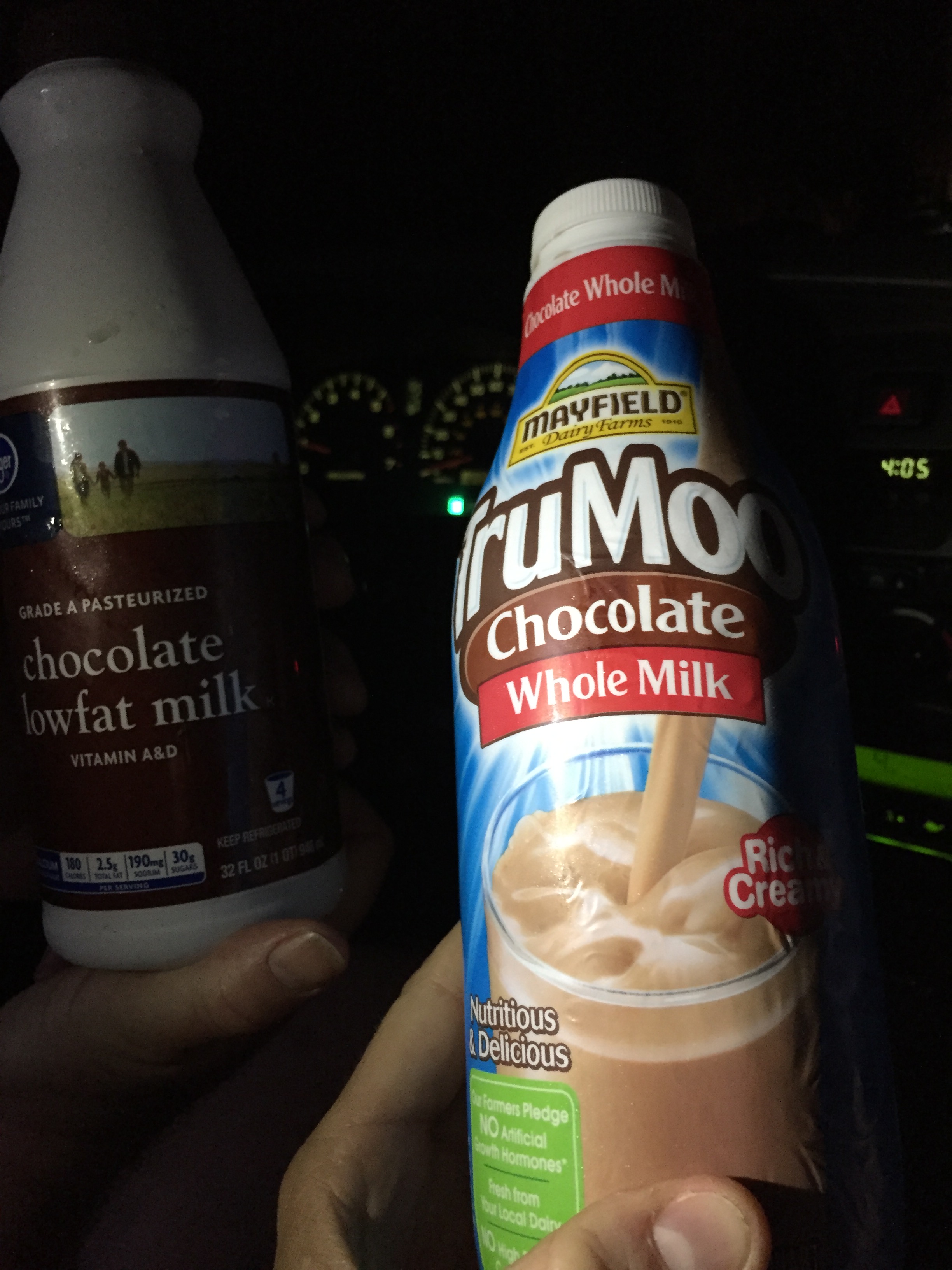
After preparing our gear and nutrition the night before and getting a good night’s sleep, we left my house in Sevierville at 7am on Saturday morning driving both of our vehicles. There were several magnificent views of LeConte on our way to the Porter’s Creek trailhead in the Greenbriar area. We dropped off Shawn’s car and would not see it again until the next morning. We left it stocked with chocolate milk to dream about for the next 46 miles.
We then drove my car to the Rainbow Falls trailhead, asked a fellow hiker to snap a quick photo at the trail sign and began our first ascent at 8:30am.
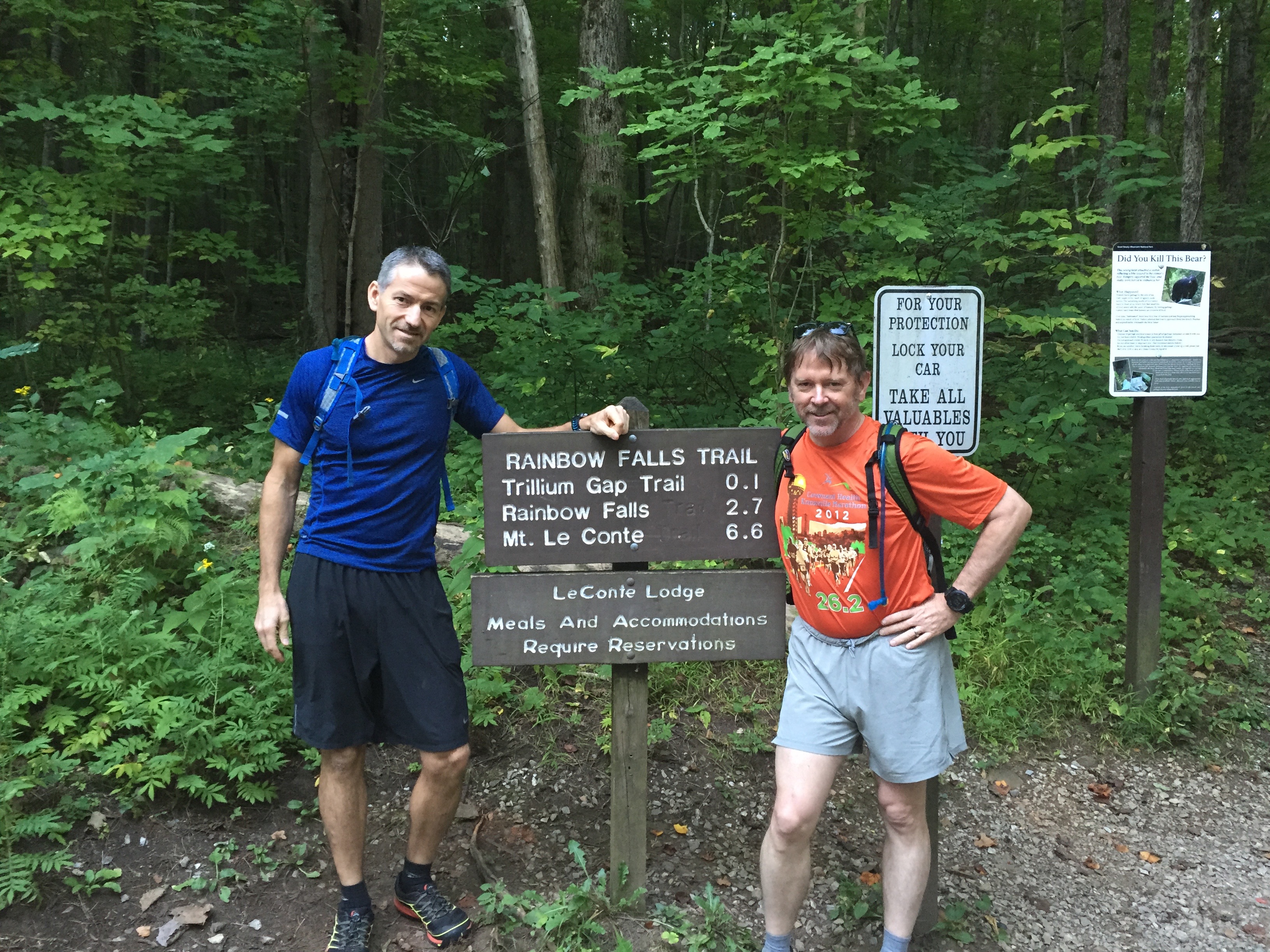
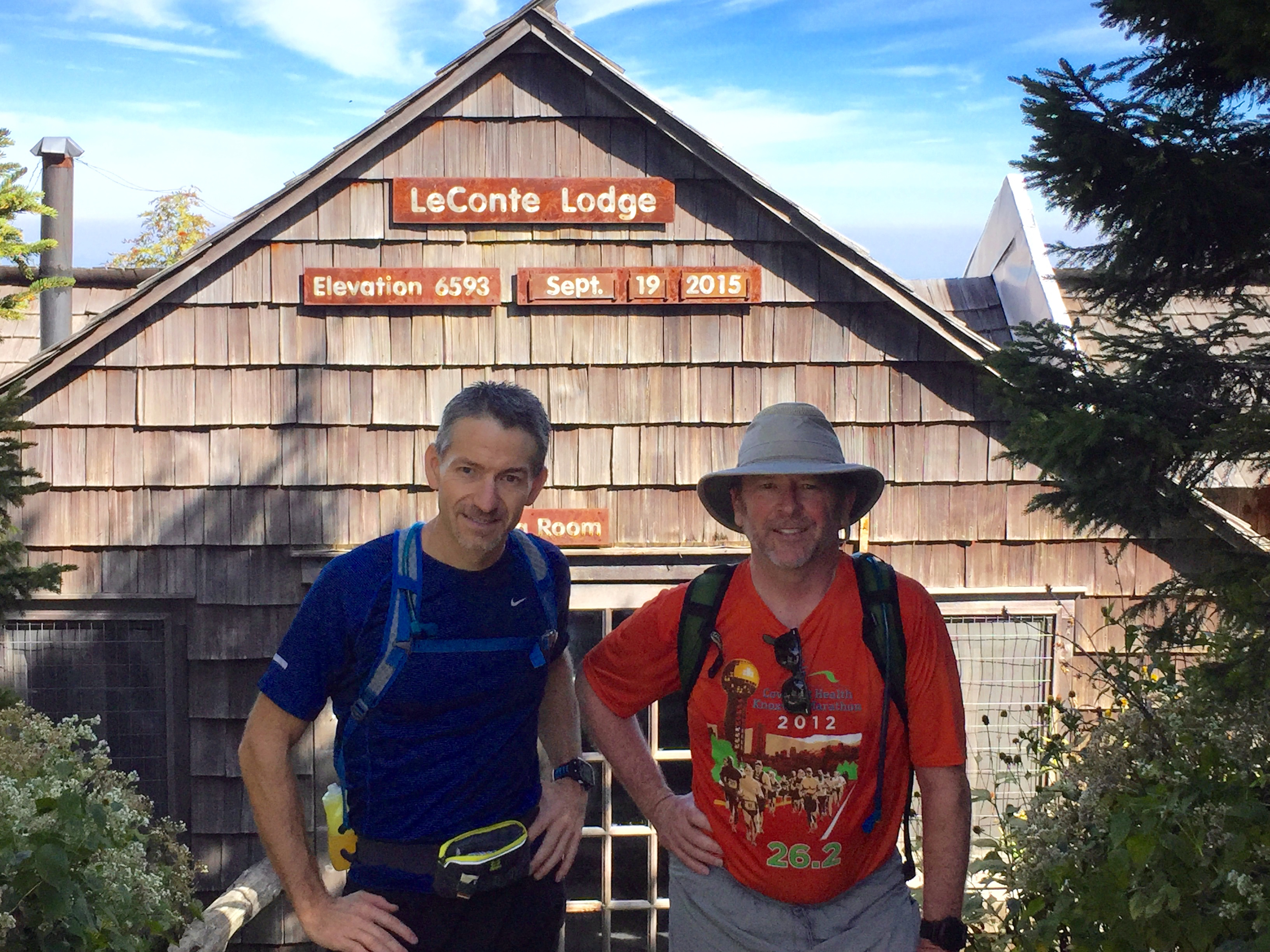
The temperature was a comfortable 60 degrees, with a prediction of a sunny day with highs in the low 80s. We intentionally took things nice and easy, keeping our heart rates around 125 bpm. We made it to Rainbow Falls (2.7 miles) in about an hour. A few hours later, we posed for the traditional photo in front of the lodge at 11:17am, grabbed a snack, and began down Trillium Gap trail.
After descending 3.6 miles, we came to a junction. Our thoughts at this point: Going left would send us back towards our car, going right is Brushy Mtn trail (that we will do as our last trail), and going straight will lead us up the 0.4 mile spur trail to the top of Brushy Mtn. While this spur trail isn’t part of what we wanted to accomplish today, we decided to do it anyway. With Shawn starting his next 900 miler, not getting this trail out of the way now would mean he would need to hike at least 10 miles extra just to get to this short trail at a later date. The views of LeConte and of Pigeon Forge and Sevierville from the top of Brushy Mtn were worth the extra effort (0.8 miles, 200’ elevation gain, 24 minutes).

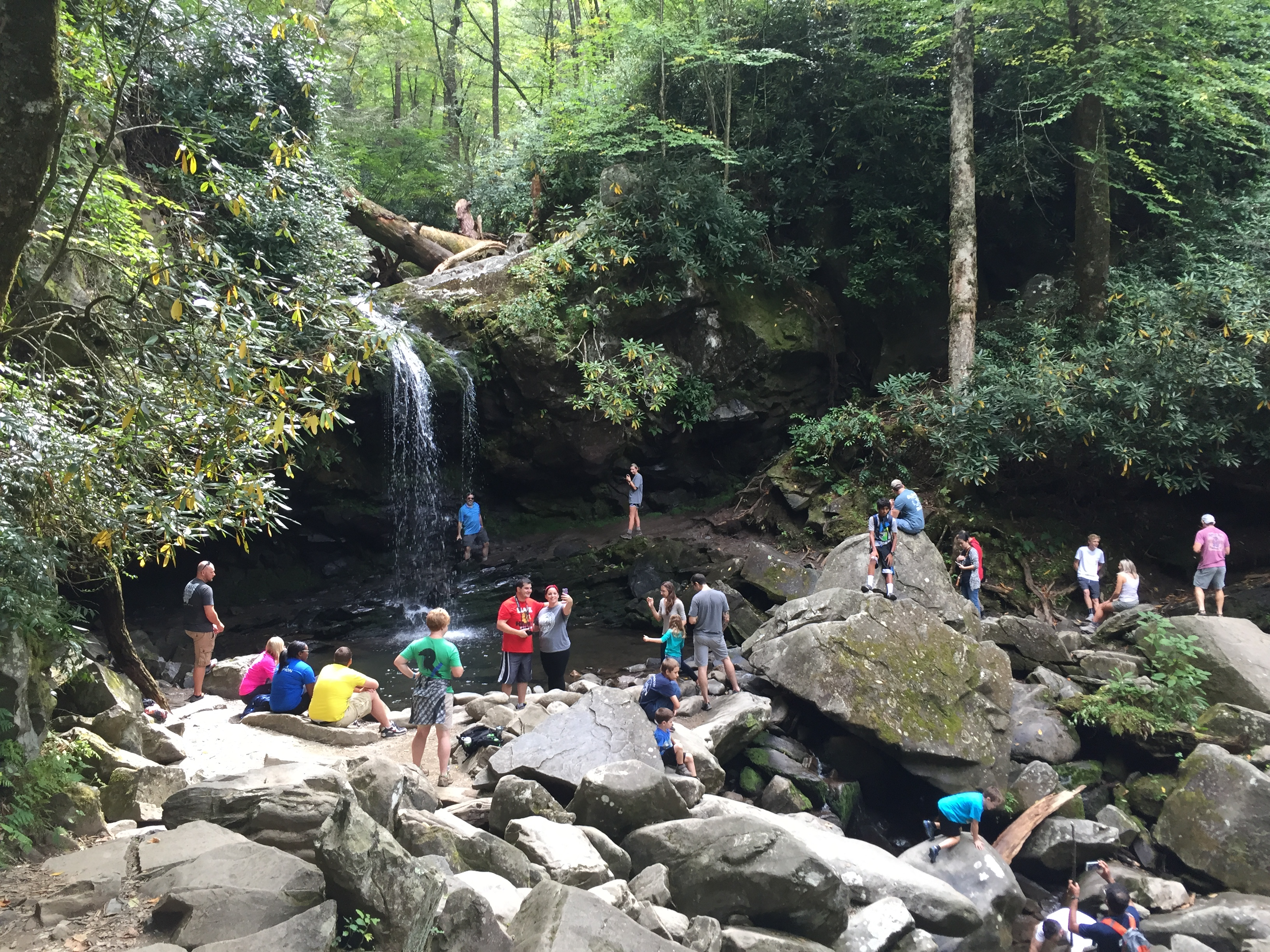
We continued on and found a party going on at Grotto Falls. People were taking turns getting their photo made standing behind the falls. Some were playing in the water, while others were eating a snack and resting. I got a kick out of a “weight-challenged” lady sitting on a rock. She paused her cellphone conversation to offer me encouragement. She told me the way back down would be easier than the way up (Grotto Falls is 1.3 miles from the trailhead). I encouraged her as well.
We took a left at the Trillium Gap trailhead and hiked the gently rolling connector trail back to where we’d parked. We made it back to the car a few minutes after 3pm. We spent 20 minutes at the car eating “lunch”, refilling our water bladders, and stocking up on food for the trail.
Our second ascent (up Bullhead) began at 3:29pm, about 35 minutes ahead of schedule. There were two memorable incidents that occurred on the Bullhead trail:
- About halfway up, we passed 3 guys that warned us about bees that were residing in a stump alongside the trail. They had been stung and wanted us to be careful. We kept an eye out for their clues as to where to look. About a mile and a half later, we saw exactly what they had described. Shawn cautiously led us by the danger zone. We crept quietly and stealthily by and just about the time we felt safe again, Shawn felt a terrible sting on his left calf. The spot continued to grow and show irritation, but it didn’t slow him down one bit. Incidentally, four years ago, Tyler, Davis, and I were stung on this trail, while Shawn skated by. Now we’re even!
- About a mile after the bees, we ran across 4 nice ladies that we had seen on the Trillium Gap trail earlier in the day. They were completing a very ambitious day hike of climbing Trillium Gap and descending Bullhead. Once they realized that they had seen us before, they said “What are you doing?!?” Although we stopped and chatted with most everyone we passed, we rarely explained our plans. We decided to share our agenda. Their next question was “Why?!?” We answered that we simply wanted to challenge ourselves to see if we could do it. They offered great encouragement as they cheered us on.
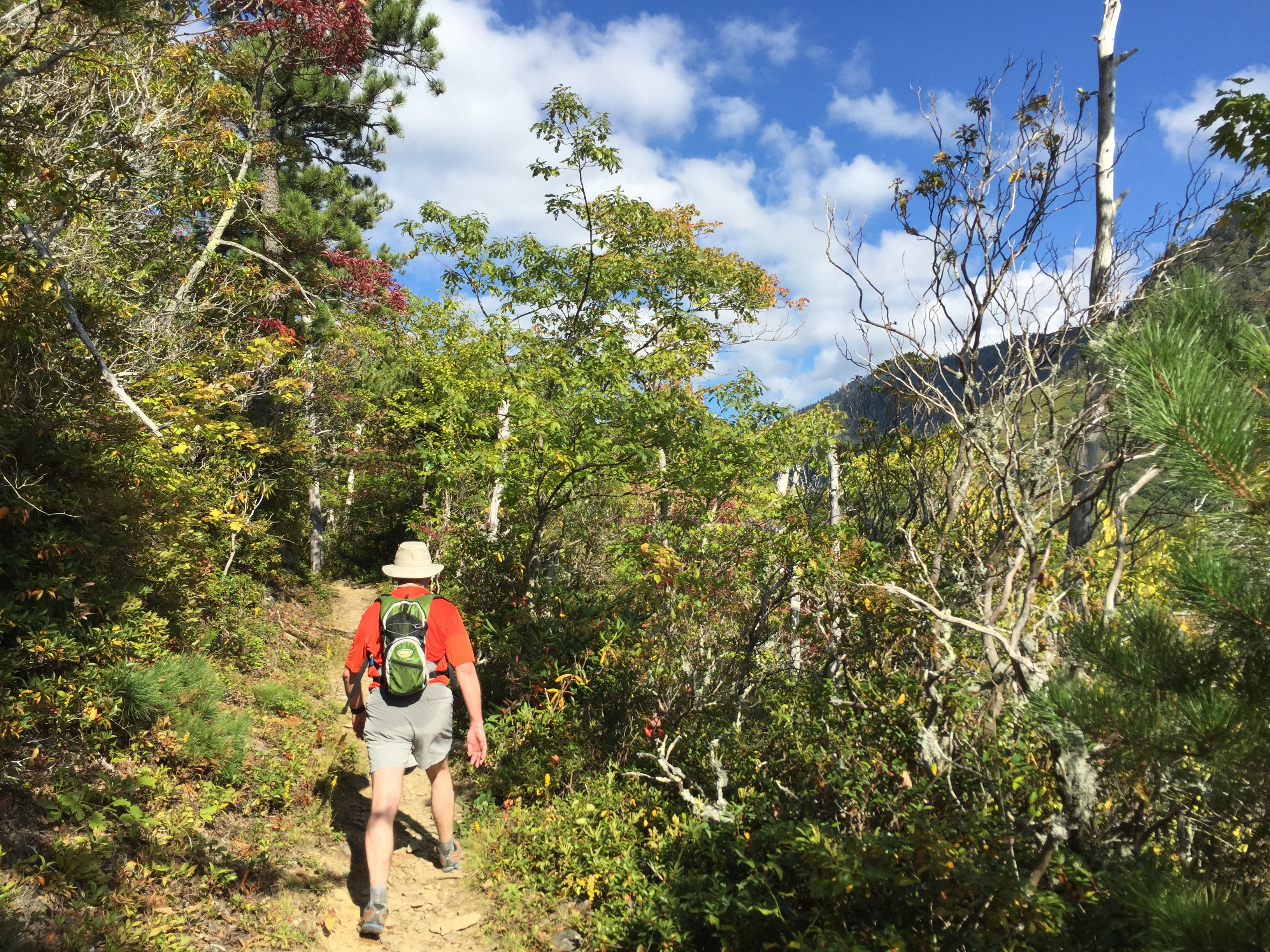
We saw some great color at higher elevation:

Scenery along Bullhead:
We stopped for a snack at the top of Bullhead, before descending Alum Cave Bluff trail. We were both still feeling relatively good at this point. We enjoyed the remarkable views on the way down, including a colorful sunset around 7:30pm.


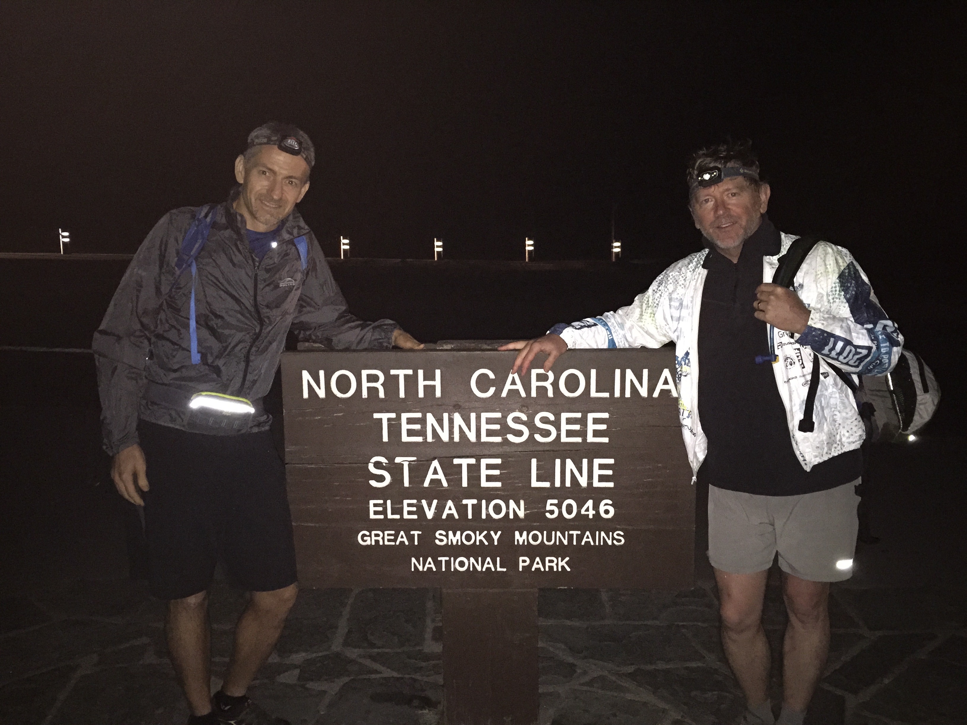
We hiked the final 2 miles of Alum Cave Bluff trail in the dark (with the help of headlamps). We found my wife, Tina, waiting for us at the trailhead with more food and water. She shuttled us to Newfound Gap, took a photo of us at the NC/TN state line, and sent us on our way.
We noticed a significant drop in temperature as we got out of the car, so we donned a lightweight layer and started up the Appalachian Trail toward the Boulevard trail. Our elevated heart rates caused us to shed our jackets within about 10 minutes. We never needed them again.
Some people have the misconception that the Boulevard trail is the easiest way to get to LeConte, since it starts around 5,000’ and LeConte is 6,594’. However, there is no easy way to get to LeConte. The trail climbs a little over 1,000’ along the AT in about 2.5 miles. After turning left onto the Boulevard trail, you descend back down to 5,500’ in about 1 mile and continue ups and downs for the next 3 miles. The final 2 miles involve a strenuous ascent until finally coming to the sign for Myrtle Point. We arrived at the top for the final time at midnight.

Pile of rocks known as High Point
We were still feeling pretty good and decided that since it was all downhill from here (basically), that we would skip break time and immediately begin our final descent.
To get to the Brushy Mountain trail requires a repeat of 3.6 miles of the Trillium Gap trail. We were very glad to get off of the rocky Trillium Gap, until we turned right onto what has to be one of the worst maintained trails in the park! The first several miles of Brushy Mountain trail involved a recessed footpath with steep walls on each side that left enough room for one foot at a time to step. Weeds and overgrowth blocked our view of the rocks and roots below. It didn’t help that we were doing this section in the dark. We had to slow down our pace and take great care with every step we took. We did not want to end up with a twisted ankle in the middle of the night this far from a trailhead.
In addition to terrible trail conditions, other issues began to pile up against us:
- Fatigue – Our muscles and joints were screaming at us to stop.
- Navigation – We had been relying on our Garmin GPS watches to give us a gauge for how far we had travelled, our pace, and how far we had until the next junction. Both of our watches died on our final descent. We kept mistakenly thinking that the gravel road at Porter’s Creek was just around the next bend. It was torture!
- Lack of nutrition – One of the things we both did wrong this time is that we didn’t eat enough on our last trip up the mountain. We ran out of energy on the way down. We both got nauseous and couldn’t eat at that point. The last several miles were a struggle just to keep putting one foot in front of the other. In hindsight, we believe that we would have finished stronger if we hadn’t stopped eating and had consumed about 1,000 more calories over the last 4 hours.
We were very relieved when we finally saw the gravel road, knowing that we only had 1 mile to go! We slowly began increasing our pace, knowing that if we could maintain 3 mph, we would be finished in 20 minutes. To our delight, the bright beam from Shawn’s fancy new headlamp bounced off of the reflector stripes on the gate, signaling that we had completed our journey.
We fist-bumped and checked the time. It was 4:02am which meant that we had finished in 19.5 hours. We not only beat our previous time of 22 hours, we added the Brushy Mtn spur trail (0.8 miles, 200’ elevation gain) and beat our goal of 20.5 hours.
We celebrated by sipping ice cold chocolate milk as we drove to pick up my car and head home.
We both had prior commitments on Sunday, but tried to sleep as much as possible. We spent time on Monday discussing our thoughts.
Neither of us remembered feeling quite so poorly after the last time, but Tina assures me that I was in plenty of pain back then, too. We both agree that it will be a long time before we forget how difficult those last few miles were and the way our bodies felt the day after! I’m not sure what we expected after taking over 100,000 steps with little to no rest.
Here is the final breakdown of how long each segment took to complete:

Brian’s Garmin GPS data:
Thoughts about Nutrition
Shawn wrote a nice article 4 years ago regarding nutrition (Shawn’s article). We basically followed the same guidance this time around.
Below is a photo of some of the things that I carried.
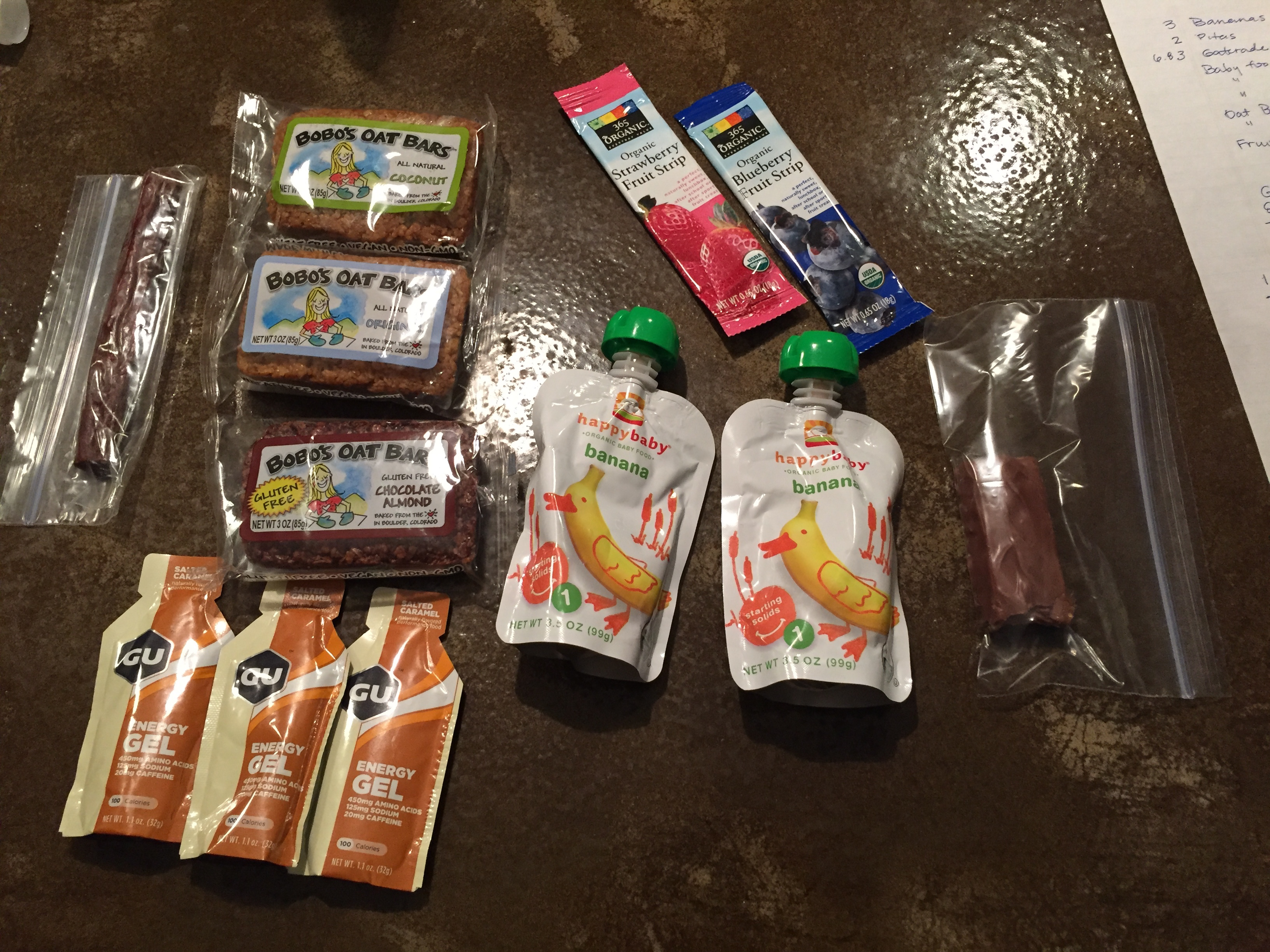
At the car, I had turkey and swiss stuffed inside pita bread. I also had several spoonfuls of chocolate hazelnut PaleoButter inside pita bread. (buy it here).
Here is a complete list of what I (Brian) ate, along with the calorie count.
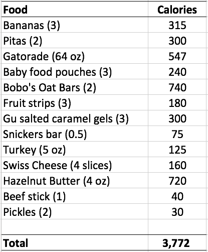
I would guess that we were burning between 300 and 500 calories per hour, depending on whether we were going up or down hill. Our heart rates averaged 125 bpm while climbing and 100 bpm during the descents. After adding up the total calories that I consumed, there is no wonder that I ran out of energy. I had been consuming around 300 calories per hour during the first 30 miles, but didn’t feel hungry on the final time up the mountain. I ended up consuming very little on this last leg. Overall, I averaged 193 calories per hour during the entire hike – which was not enough.
Lesson learned: EAT! Even when you don’t feel like it!


 Pocket knife


